
Moisture-packed system set to drop copious rainfall totals in Ontario
We hope you enjoyed the sunshine on Wednesday, southern Ontario. It will be the last of it you will see for the near future.
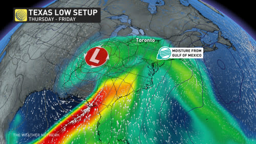
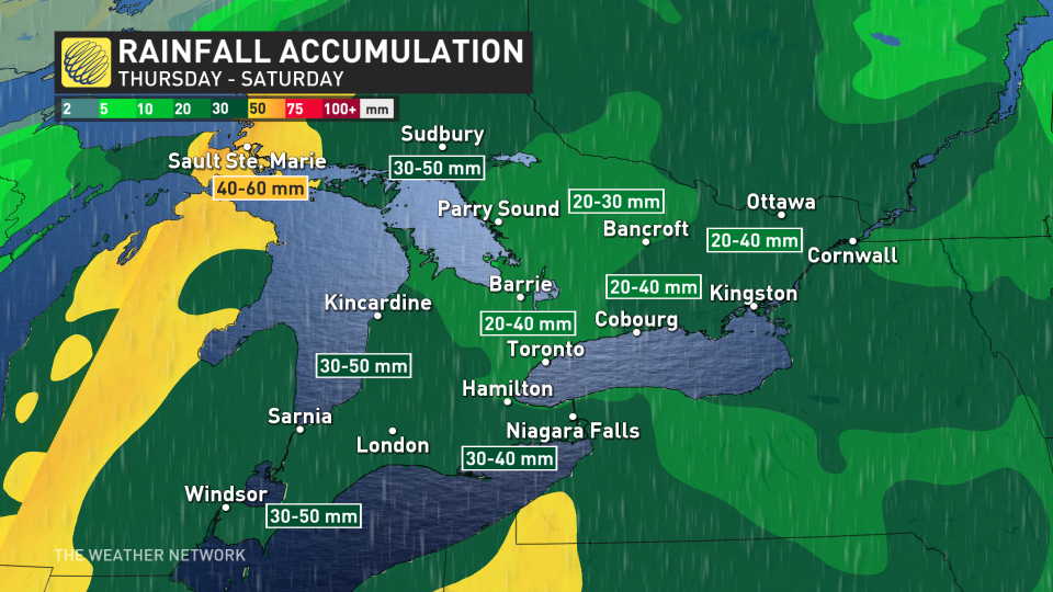
A Texas low moving north will drag abundant Gulf moisture into the province on Thursday, with multiple days of rain that could add up to 50 mm into Saturday. The result could be some localized flooding, possibly impacting travel with water pooling on roadways.
DON'T MISS: IN PHOTOS: Millions gather around the world to witness the total solar eclipse
In addition to the drenching rains will be a risk of embedded thunderstorms. Stay alert to the changing conditions in your area.
Once the system departs on the weekend, parts of Ontario could see a changeover to wet snow.
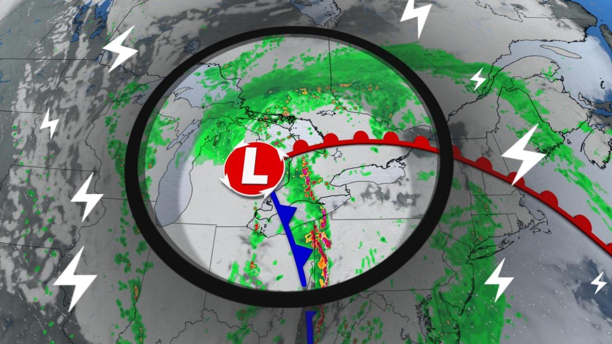
Localized flood threat with days of rainy weather
A Texas low will then track into the Great Lakes region during Thursday, bringing widespread periods of rain as it scoops up a stream of moisture from the Gulf of Mexico.
Rainfall will be in full force Thursday morning. There is a chance for some embedded thunderstorms during that time, which could enhance rainfall intensity, bringing the risk for localized flooding to some of the hardest-hit areas through the day on Thursday.
The cold front will then inch into southwester Ontario Thursday evening and continue trekking into the Greater Toronto Area (GTA) in the overnight period.
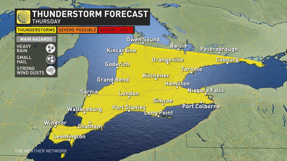
There is a chance of stronger thunderstorms to occur from 6 p.m. to 9 p.m. along the Lake Erie shores. Forecasters will be keep a close eye on the possible development.
WATCH: These stormy scenes from the Deep South are heading to Canada next
A dry slot is expected for a while on Friday, though with much cooler temperatures with the passing of the cold front. There is a chance of showers on the backside of the system during the afternoon and evening hours on Friday.
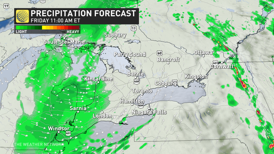
Winds will also pick up on Friday night, with showers lingering into Saturday morning across the GTA, lasting longer across parts of eastern Ontario before gradually tapering off in the afternoon.
Across much of southern Ontario, between 30-50 mm of rain is expected through Saturday, while northeastern Ontario can expect 40-60 mm.
In true Ontario spring fashion, as the system departs Saturday, a changeover to wet snow is likely over northeastern sections, and even across the higher elevations of southern Ontario.
Sunday will be cloudy with sunny breaks possible, but also a risk for a period of showers at times. Abundant sunshine and pleasant conditions will take hold for early next week, as temperatures bump back up several degrees above seasonal. Another shot of cooler weather is expected for a few days next weekend.
Stay with The Weather Network for more forecast information and updates as we continue to monitor your weather in southern Ontario.

