
Ontario bracing for heavy snow, soaking rains, gusty winds Friday
In like a lamb and certainly out like a lion, as March's final "roar" will bring a significant storm system into Ontario for Friday. The impacts you see will depend on where you are in the province.
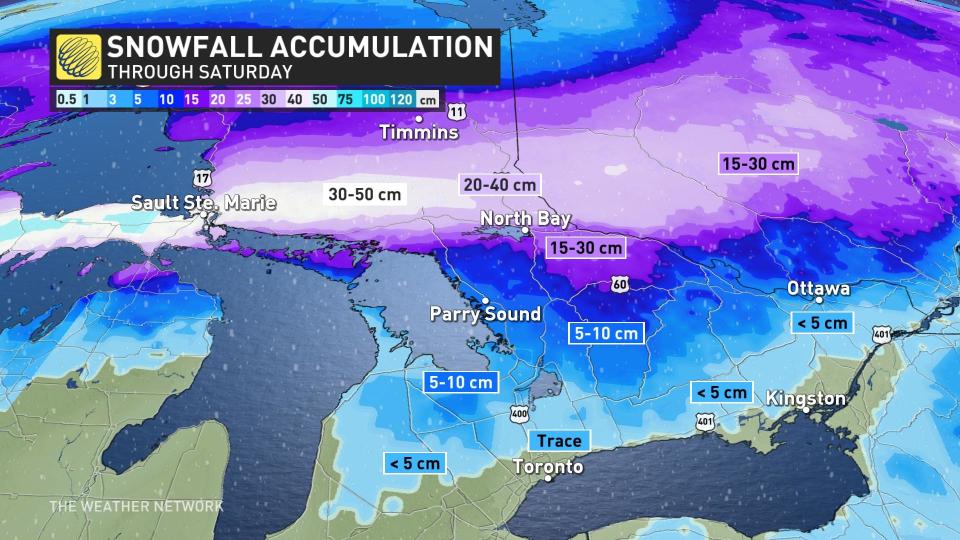
The storm’s track will cut a sharp divide across Ontario, with heavy snow plastering parts of the north and steady rains soaking the south. Expect significant impacts to travel across areas expecting heavy snowfall, as totals could reach as much as 50 cm through Saturday.
MUST SEE: March madness: Canada’s month-long, wild ride of weather
Colorado low sees sharp divide between heavy snow and wind-whipped steady rains
A beefy Colorado low will drag plenty of moisture north across the border, fuelling a significant round of snow for parts of northern Ontario while folks across the south deal with a spell of soaking rains on Friday.
This low-pressure system will deepen in a hurry as it pushes into the Great Lakes from the west. The centre of the low will track close to Georgian Bay overnight Friday into Saturday, placing the dividing line between rough wintry weather and dismal spring-like weather right through the heart of cottage country.
LEARN MORE: A cavalcade of Colorado lows can send Canada’s forecast into upheaval
We’ll see precipitation push into central and southern Ontario early Friday morning, with a soggy commute on tap for much of the region. Precipitation will grow heavier overnight Friday into Saturday.
WATCH: Colorado low to bring severe storms stateside, thunder possible in Ontario
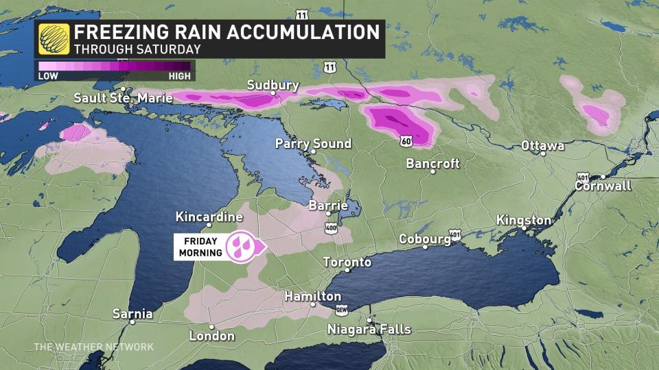
During the pre-dawn hours on Friday, there is also a risk for freezing rain across parts of southwestern Ontario from Stratford up to Georgian Bay. Despite being relatively light, the icy glaze could create some slippery conditions for the early morning commute. There is a risk for icy precipitation across the northern shores of Georgian Bay, Manitoulin Island, and over to Algonquin Provincial Park as well.
DON’T MISS: Allergy season is coming. Get ahead of it with these must-haves
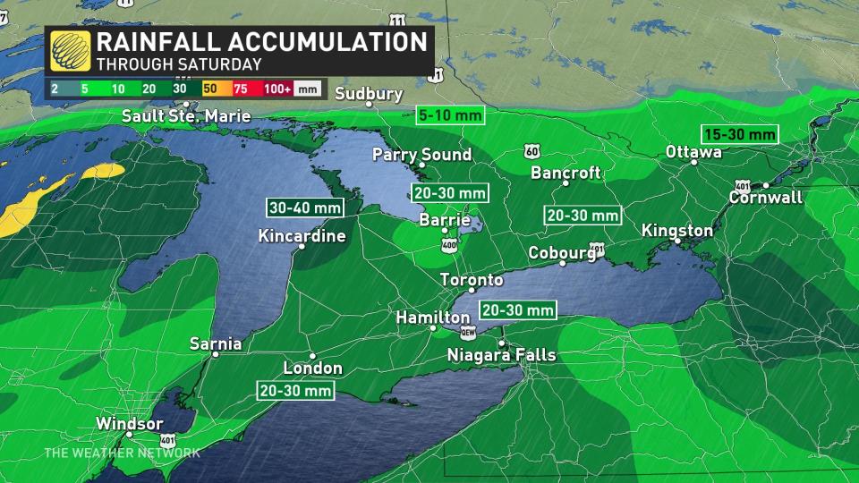
A steady, drenching rain will leave behind widespread totals of 20-40 mm in the gauges by the end of the storm on Saturday, with higher totals possible toward the shores of Lake Huron. Gusty winds will also accompany the rain and warmer temperatures.
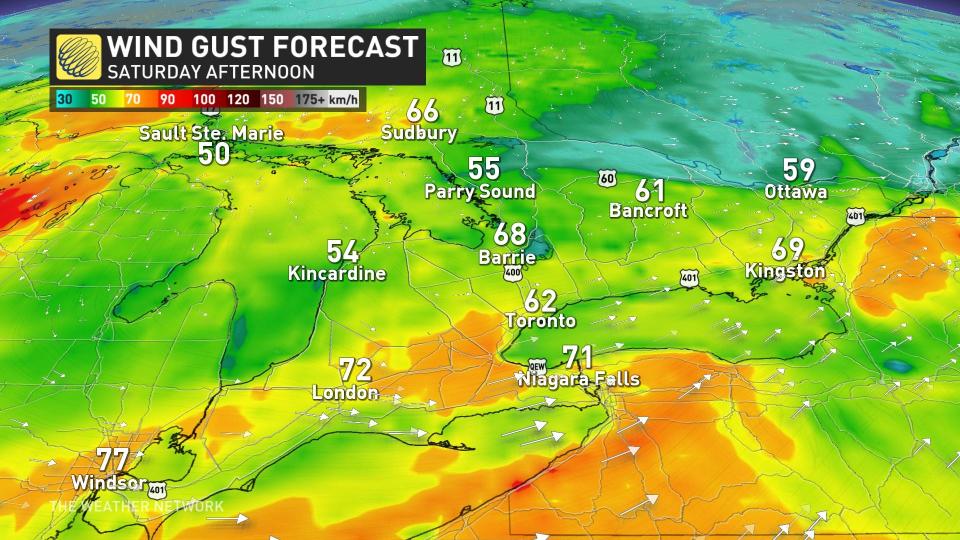
Wind gusts of 60-80 km/h are likely across southern Ontario heading into the day Saturday. The combination of gusty winds and wet soils could lead to localized tree damage and power outages.
RELATED: Thundersnow strikes southern Ontario (again)
Threat for 30-50 cm of snow by Saturday
Farther north, cold air will make for a significant snowfall event for parts of northern Ontario. Folks from Sault Ste. Marie to Sudbury could see 30-50 cm of snow by the time the storm clears out on Saturday. The swath of heaviest snow is narrow and will heavily depend on the ultimate track of the low-pressure system.
Heavy snow and gusty winds will lead to low visibility on roads at the height of the storm. Travel will be significantly impacted throughout the region, including along stretches of the Trans-Canada Highway.
Calmer and cooler conditions will prevail behind the storm by Sunday.
An active pattern with changeable temperatures is expected to continue through the first week of April however, as a few more significant systems track across the region. For some areas, the warm temperatures on Saturday could be a preview of what’s ahead next week.
Be sure to check back for the latest weather updates across Ontario.

